Translate

Monday, January 21, 2019

Lunar Eclipse: January 20 - 21, 2019

After my Women in Music, Polka Time, and Classic Country radio shows on WTIP yesterday, I turned up the long, cold Gunflint Trail.  By the time I got as far as the Pincushion Mountain Overlook Trailhead, the eclipse of the super perigee (point of closest approach) moon had begun.  I pulled into the parking lot, and took several pictures.  The air temperature was at -16 degrees Fahrenheit, and I had to keep wiping the ice off the camera lens.  My first battery fizzled, and I replaced with the fully charged one from inside my car.  Amazingly enough, that was the warm part of the journey.
Moon from Pincushion Mountain Overlook at ~9:45 PM.  Temperature -16 F.
I continued up the Gunflint Trail, glimpsing at the moon through my moon roof from time to time.  The next photo stop I made was at the Gunflint Trail Volunteer Fire Department Hall # 1 by Poplar Lake.  Temperatures outside had plummeted as far as -29 degrees Fahrenheit, and had risen to -28 F. by the time I got out of my car at the fire hall.

I quickly took some more pictures, being careful not to breathe towards the camera lens, as the moisture would instantly freeze.  Even with my precautions, I still had to wipe off ice several times.  The moon was nearing full eclipse by this time.

Moon From GTVFD Fire Hall 1 at ~10:27 PM.  Temperature -28 F.
I got back into the car, and continued to Gunflint Lake.  On the journey, I had my air heaters and seat heaters on high.  The inside of the windows behind me were fully coated with ice from my breath, although I was warm in the driver's seat.  Temperatures ranged from -26 to -29 degrees Fahrenheit.  When I parked my car, the final temperature was -28 degrees F.  On the way, I was secretly hoping for -30 Fahrenheit, so I would have better stories later on.  Part of the fun of living in far northern Minnesota are the great weather stories you accumulate over the years.

By the time I parked, the moon was fully eclipsed.  I took a few pictures, unloaded my car, and took some more pictures from my deck.  A short distance away, Gunflint Lake sounded an occasional thunderous boom from the rapid production of ice.

 I experimented with long exposures, hand held shots, and pictures taken from my tripod.  The best pictures seemed to come from the Handheld Night Shot setting, taken from the top of the tripod, with a timer.
Full Eclipse of the Moon from Gunflint Lake at ~11:15 PM.  Temperature -28 F.
Full Eclipse of the Moon
After taking many pictures, I went inside to warm up.  It took quite a while for my feet to get warm, and I will be re-hydrating my hands for the next few days, but it was worth it to see this beautiful eclipse of the perigee moon. 

I'm thankful to have had such a clear night.  As I write this, it is cloudy, and the National Weather Service is predicting a 100% chance of snow this evening.

I went outside one more time before bed.  By this time, it was the next day, and the moon was coming out of eclipse.
Waning Lunar Eclipse from Gunflint Lake after Midnight on January 21, 2019

Thursday, January 3, 2019

Wild West Trip - South Dakota, Wyoming, and Utah


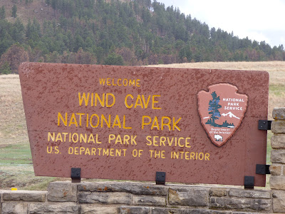
I started out May 9, 2018 at the Elk Mountain Campground in the Wind Cave National Park.  It was a beautiful day to drive across the rest of South Dakota, Wyoming, Utah, and part of Nevada.  Before the day was done, I drove 858 miles over 14 hours.  I took one hour-long break to walk around Independence Rock, Wyoming, and a few minutes to look at Temple Square in Salt Lake City.
Elk Mountain Campground, Wind Cave National Park, South Dakota

Elk Mountain Campground, Wind Cave National Park, South Dakota
When I was in elementary school, we would play a game called Oregon Trail on the old Apple II C and E computers.  In the game, we would go from place to place on aboard a covered wagon, have to figure out what provisions to bring along, and which chances to take on the trail.  There were many landmarks along the route, one of which was Independence Rock, marking the halfway point between the Missouri River and the Pacific Ocean.

When I was driving through Wyoming, I saw the signs for Independence Rock, and thought it would be fun to see the landmark.  I knew I had a long way to travel that day and didn't think there was time to take a side trip.  However, I pulled over at a scenic rest stop, and found that I was actually at Independence Rock.  The historian in me wanted to take a walk around.  Independence Rock is deceptively large, and it took about an hour to circumnavigate it on foot.  I saw evidence of the pioneers on the rock, and saw some great wildlife in the surrounding countryside.
Independence Rock, Wyoming

Independence Rock - Wyoming

American White Pelicans (Pelecanus erythrorhychos) at Independence Rock, Wyoming

American White Pelicans (Pelecanus erythrorhychos) at Independence Rock, Wyoming

The Pronghorn (Antilocapra american), fastest animal in North America, sprinting by Independence Rock, Wyoming.

Path Around Independence Rock, Wyoming
Western Meadowlark (Sturnella neglecta) at Independence Rock, Wyoming


 The next state I drove through was Utah, a state I had never set foot in before.  I enjoyed the scenic mountains and saw the sun set over the Great Salt Lake.  In Salt Lake City, I took a little detour to see the Mormon Tabernacle.  When we took road trips out west growing up, we would often listen to a recording of the Mormon Tabernacle Choir called Best Loved American Folk Songs: This Land is Your Land.  It seemed fitting to catch a glimpse of the place the recording happened on my own road trip out west.
Mountains in Utah
Temple Square in Salt Lake City, Utah - The Mormon Tabernacle is visible through the trees.
 In a few more hours, I arrived at my cousin's house in Elko, Nevada.  The first half of the trip, I had driven around 24 hours, and covered 1,984 miles. 

Monday, December 31, 2018

Wild West Trip - Minnesota and South Dakota

Red Fox (Vulpes vulpes)
 My wild west trip started early on May 6th.  When I arrived at my car, their was a fox waiting for me.  It watched me from about 10-feet from the car, and jumped back when I started the engine and backed out.

My first day's drive ended in the Twin Cities after a 300-mile drive.  I spent a nice night with my parents before heading off early the next morning for the Badlands National Park.


Storm over the Prairies Near Wall, S.D.
 Most of South Dakota is quite flat, which makes it easier to see the storms coming.  Near Wall, South Dakota, I saw several amazing storms crossing the prairie.  After a brief stop at the famous Wall Drug Store, I entered the Badlands National Park, and found my way to the Sage Creek Wilderness Campground.

Since there were storms visible all around the campground, I decided to spend that night inside my car.  When the storms blew through in the middle of the night, I was glad I had made that decision.


Wall Drug Store, S.D.
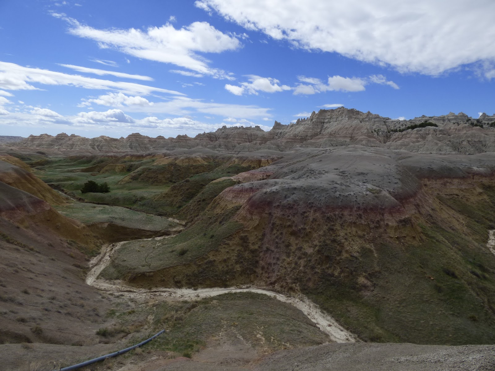
Badlands National Park, S.D.
Then next morning, I was awoken by the serenade of the western meadowlark.  I got out of my car to enjoy the beautiful music, identify the bird, and get some pictures before climbing back into the car to get a little more sleep. The campground was beautiful around sunrise.
Western Meadowlark at the Sage Creek Wilderness Campground, Badlands National Park, S.D.

Sage Creek Wilderness, Badlands National Park, S.D. at Sunrise
When I got up again, people were moving around the campground.  Much to my delight, prairie dogs were within the campground, and bison were roaming on the outskirts.  I enjoyed a quick breakfast and went exploring on foot to see the fascinating geology and wildlife of that beautiful Sage Creek Wilderness campground.

After breaking camp, I took the road tour of the Badlands National Park.  The geological formations, and wildlife were spectacular.  Some of the wildlife highlights were the prairie dogs, bison, pronghorn, and many great birds.
Prairie Dog

Prairie Dogs
Sage Creek Wilderness, Badlands National Park, S.D.

Bison in the Badlands National Park, S.D.

Pronghorn in Badlands National Park, S.D.

Badlands National Park, S.D.

Badlands National Park, S.D.

Badlands National Park, S.D.

Mt. Rushmore, S.D.
After touring the Badlands National Park for several hours, I drove to Mt. Rushmore.  It was fun to see these famous carvings as well as all the state and territorial flags, and read about the history in their visitor's center.  On the way out, I stopped at a wayside to get a side view of the presidents, and also caught a distant glimpse of the Crazy Horse Memorial.
Mt. Rushmore, S.D.
Mt. Rushmore, S.D.


Wind Cave National Park, S.D.
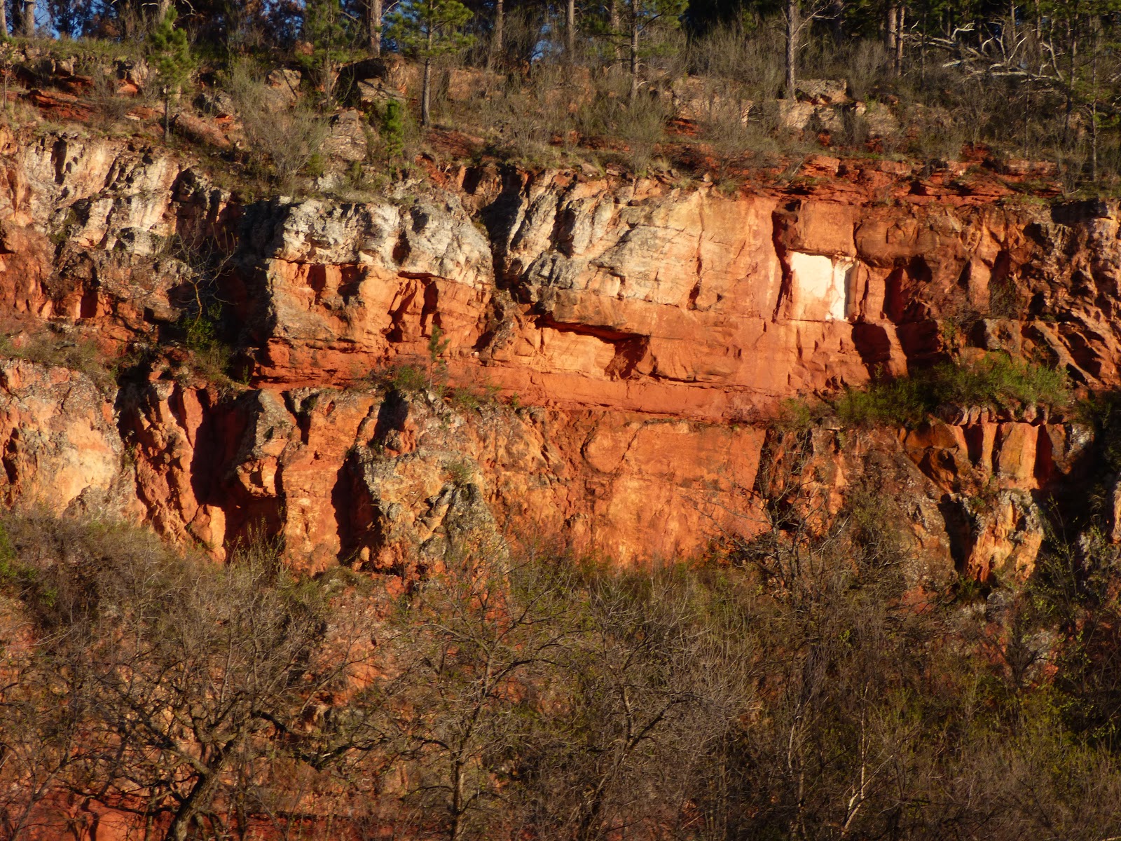
The next leg of my journey brought me through Custer State Park to the Wind Cave National Park in time to get on the last cave tour of the day. Wind Cave is the fifth biggest cave in the world, and the third biggest cave in the United States.  It is famous for the winds that come out of the natural entrance, the sheer size, and the world's largest collection of boxwork formations.  I highly recommend a tour through this unique cave system.

Please note that they are taking good steps to prevent the spread of white-nose syndrome in bats, you cannot enter the cave with any clothing that has been in another cave outside the Black Hills in the last five years.  I found this to be true in other National Parks and Monuments out west as well.
Boxwork Formations in the Wind Cave, S.D.

Wind Cave, S.D.

Wind Cave, S.D.

Custer State Park, S.D.
After the tour, I took a quick drive around the very scenic Custer State Park, and spent the night in the Elk Mountain Campground of the Wind Cave National Park.
Bison with Calves in Custer State Park, S.D.

Bison Herd in Custer State Park, S.D.

Friday, December 7, 2018

Thin Ice

Last night, we had temperatures at Gunflint Lake down to - 11 degrees Fahrenheit.  It was a calm night, and Gunflint Lake was frozen by morning.  If we are lucky, it will be safe for travel close to the end of December.

Gunflint Lake is 275 feet deep at the deepest hole.  With that volume of water, it takes a long time to change temperature enough to freeze.  Every year, Gunflint Lake ices over after the lakes in Southern Minnesota (including the Twin Cities).  Remember to check on the ice before going on it.

The Minnesota Department of Natural Resources recommends at least 4 inches of new, clear ice for walking, 5 - 7 inches for snowmobiling, 8 - 12 inches for a small car, and 12 - 15 inches for a medium truck.  Double those amounts for white ice.  Remember, ice is never 100% safe!  For more information, see the Minnesota Department of Natural Resources Website.

Many people are killed every year by traveling on unsafe ice.  Over the years, many more people have been killed trying to rescue the people stupid enough to go out on thin ice.  Remember, that travel on thin ice not only risks your own life, but the lives of rescuers as well.

When the ice is thick enough to travel, I recommend bringing some ice picks. They can be put on a rope and easily carried with you.  I've tested these (when I was wearing an ice rescue suit during fire training), and they work well.

If you drive on the ice (which I don't), leave your windows down while in the car.  Your best chance of survival is to get out of the car before it sinks.  When a car goes down, it will go engine first, and most likely flip over on the bottom of the lake.  Unless you have something to break the window, you have to wait for the car to fill with water before attempting to swim through water colder than you can image to the surface, and hope you can find the hole you came through and pull yourself out onto the ice.  I personally recommend driving only on land.

Another thing to remember, just because someone else has gone on the ice does not mean you should go on the ice.  We are humans, not lemmings.  Pay attention to the "Thin Ice" signs, talk to people who live on the lake, and test the ice before walking on it.

Stay safe out there!


Tuesday, August 21, 2018

The Passing of Ronny Setniker - A Polka Legend

When I was hosting the Polka Time show on WTIP last Sunday, I got some sad news.  Ronny Setniker had passed away.  Even before I got the call, I had been planning on playing some of his music in the next set, as I had in many shows before.

I confirmed the information online at https://www.wdio.com/news/ron-setniker-polka-music-accordion-range/5035057/.  There was a nice tribute to him on the newscast.

There is one thing that set Ronny Setniker apart from the other musicians I play on my my shows.  Every few months, he would call me and thank me for playing his music, and that of his family.  In my 9-years on the air, he was the only musician not in the studio with me to do so.  I always enjoyed our conversations, and will miss hearing from him.

One time, he called me up and said that he had been honored to have a Polka written in his honor by another musician named Bud Hyrczyk.  He said he was very humbled by the honor, and asked for my address, so he could send me the CD.  It was called the Setniker Polka, and I ended my show on Sunday with that song.

According to the news story listed above, and the biography on Ronny's website, he was a Grammy nominee in 1998 and 2007.  On June 24th, 1999, he was inducted into the Ironwood Polka Hall of Fame.  He was also a Vietnam Veteran, and a retired steelworker.

According to his website, his most recent album was called Tradition.  He did the album with his daughters Susan and Shelby, with whom he passed on his love on Polka music.

Ronny had been playing 4-hour shows just weeks before he died.  He passed away on National Polka Day, August 9th, 2018, at age 79.

Sunday, August 5, 2018

Blueberry Picking on the Gunflint Trail

A week ago, I took a day canoe trip on the Pine and Granite Rivers with one of my coworkers.  Those rivers mark the border between the United States of America and Canada.  To find them on a map of Minnesota, look at Cook County (the tip of the Arrowhead over Lake Superior).  Follow the international border from Lake Superior until it takes a sharp turn to the north.  You have then found the Pine and Granite Rivers.  The Pine River is south of Granite Lake, and the Granite River flows north from Granite Lake.

The two rivers are in a large granite formation (Saganaga Batholith).  Both rivers were burned during the Ham Lake Fire of 2007.  The combination of those two factors makes for some great blueberry picking.

We started out the day by paddling far down the river to the Swamp Portage.  Along the way, we stopped to eat blueberries, Saskatoon berries, and raspberries.  Our plan was to pick some berries to save on the way back.

The swamp portage was beautiful.  We had little rain for the previous few weeks, so it was not as wet as I remembered it.  However, there was still some great amphibian life present.
Northern Leopard Frog (Lithobates pipiens)

Swamp Portage

American Toad (Anaxyrus americanus)

Granite River from the Swamp Portage
After the Swamp Portage, we turned around and headed south.  There were blueberries all along the river, and we stopped a few miles to the south to pick our fill.  We also ate out lunches, as well as a lot of Saskatoon berries, raspberries, and pin cherries.

Blueberries (Vaccinium corymbusum)

Saskatoon Berries (Amelanchier alnifolia)

Bucket of Blueberries - I added a few more inches of berries after this picture was taken.
When we were finishing picking our berries, several thunderstorms came into the area.  We had to wait over an hour for the storm to pass, and then we were able to paddle home.

Thunderstorm on the Pine River
Tips of Picking Blueberries on the Gunflint Trail:
  1. Look for the best blueberry patches in the burned areas on the granite hillsides of the upper Gunflint Trail.
  2. Bring a gallon ice cream pail for carrying your berries.  It is a wide top, and carries a lot of berries.
  3. Ask the locals for good picking spots.
  4. Keep your car or boat is sight, as it is easy to get turned around in the burn areas.
  5. Be a clean picker.  Pick only the ripe berries.  It is better to sort the berries in the field instead of when you want to eat them.  Dirty pickers (who rip everything off the berry bush) are very wasteful and inefficient.
  6. Freeze your berries directly in the ice cream bucket.  There is no need to wash them until you are ready to eat them.